 Thu Apr 11, 2024 3:03 pm
Hi All,
I've been using Resolve for a few years for editing, speed ramping, color correction/grading etc.
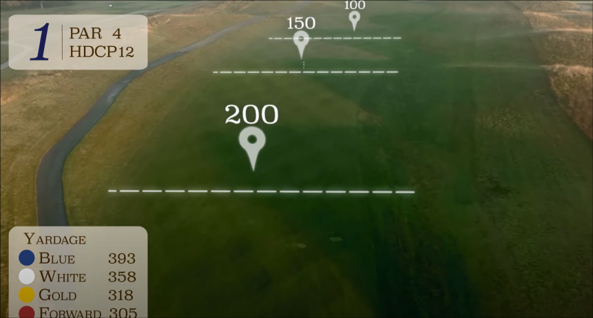
I've been asked by my local Golf Club (Ireland) to do a Drone flyover video. Showing on screen graphics / overlays of distances from tee to hole.
What I'm looking to do is like what's in the image -showing dotted lines as you fly along showing distances. As you fly the dotted lines appear smaller and fade away
As you can see there are "dynamic overlays" appearing to show the user the distances from tee to golf hole as the drone flies along the course.
Is this possible to do well (professionally) in Resolve and if anyone has any examples or even a pointer to an example of how I'd do it that would be great.
Thanks Ronan Dowd
- Attachments
-
- golf_lines2.png (419.65 KiB) Viewed 220 times